Overcome Common Mobile Mapping Challenges
- Data Management: Storing and handling large volumes of data is costly and complex
- Data Accuracy: Concerns over the precision of mobile mapping data
- Pre/Post-Processing: Manual work on data stitching, refinement and QA/QC is time consuming
- High Investment: High upfront costs for mapping systems raise ROI concerns
- Lack of Automation: Labour intensive processes make it difficult to scale and increase the risk of human error

Benefits for Mobile Mapping Partners
-
Scale your business
Our unique solution allows you to conduct large-scale mobile mapping projects and capture high-volume data (with local refinement) within 24 hours. The high quality of the data enables you to generate additional revenue by selling new solutions with valuable infrastructure asset information.
-
Large-scale data capture
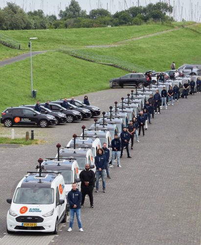
As a mobile mapping partner, you gain access to our unique vehicle setup. Your vehicle will be equipped with high-resolution cameras, up to two LiDAR scanners, and a high-quality GNSS receiver, empowering you to acquire vast amounts of data with incredible accuracy.
-
Enriched data offers greater ROI
Our bespoke approach to mobile mapping allows you to provide enriched geospatial data insights and valuable infrastructure asset information to clients. These insights help accelerate the decision-making process for infrastructure managers, expanding your service offering and value to your clients.
-
Attract new clients
We work with only one partner per region. If we receive requests for geospatial data from your region, we will refer the work to you, expanding your client base and boosting your income.
-
Automatic GDPR compliance
Concerned about data privacy when mapping public spaces? Our mobile mapping solution ensures quality geospatial data and local refinement that is automatically GDPR compliant.
How It Works ?
Interested in becoming an AI-InfraSolutions mobile mapping partner? Fill out our enquiry form and a member of the team will get back to you with more details shortly.
Initial Contact
Fill out the inquiry form and together we will ensure you meet the requirements to become a partner.
Training
Our specialists will provide in-depth training to ensure you and your team have the knowledge needed to get started.
Equipment Delivery
Client Referrals
Should we receive requests for geospatial data from your area, the request will be referred to you.
Why become a partner?
Nationwide Mapping
Access specialized vehicle setups equipped with high-resolution cameras and LiDAR scanners for accurate data collection.
Scale your business
Leverage our innovative solutions to undertake large-scale mobile mapping projects and generate high-quality data quickly.
Greater ROI
Deliver valuable geospatial insights and infrastructure asset information to expedite decision-making for clients.
Automatic GDPR Compliance
Ensure data privacy and compliance with GDPR standards effortlessly.
Accelerate time to revenue
Create enriched geospatial data that caters to diverse use cases across multiple customer segments.
Cost Reduction
Decrease reliance on manual labour, leading to significant cost savings.
Data Privacy Assurance
Automatically comply with data privacy laws and data sovereignty regulations, ensuring peace of mind.
Customer Support
Receive extensive assistance from our team, from initial setup to training.
Use AI Models
Utilise advanced AI models to flexibly meet customer demands efficiently.
Contact us.
Headquarter Netherlands
Burgemeester J.G. Legroweg 45-C
9761 TA Eelde
E-mail: info@ai-infrasolutions.com
Singapore Office
30 Bukit Pasoh Road, Singapore 089 844
Tel.: +31 85 1303 474


